This is a bit of a shameless rip-off of some of BrowhillsBob’s local history and photo features, but imitation is flattery, and it’s Bob’s fault the pictures emerged, so here we go.
During my recent search of slides a box of 1975 slides came to light, taken by my father, and someone was kind enough to scan them and do a bit of post-processing to clear up the colours for me- thanks Jim. In amongst them was a fairly good image of Barns Lane, looking over towards Stubbers Green, Aldridge Sailing Club, the old Barnett & Beddows brickworks, and in the distance, Brownhills. It’s quite interesting to compare the 1975 shot with one I took on 6th March 2011, from the same viewpoint:
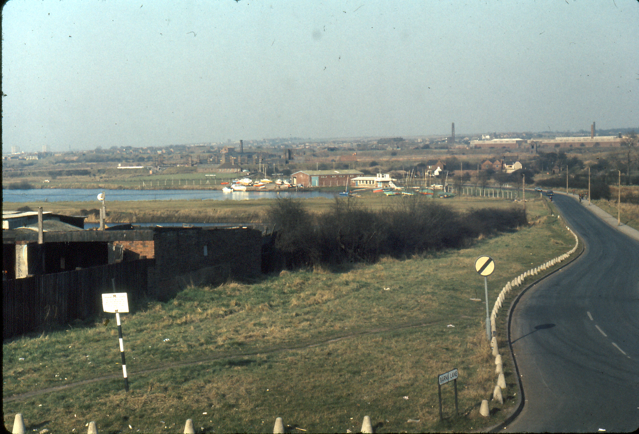
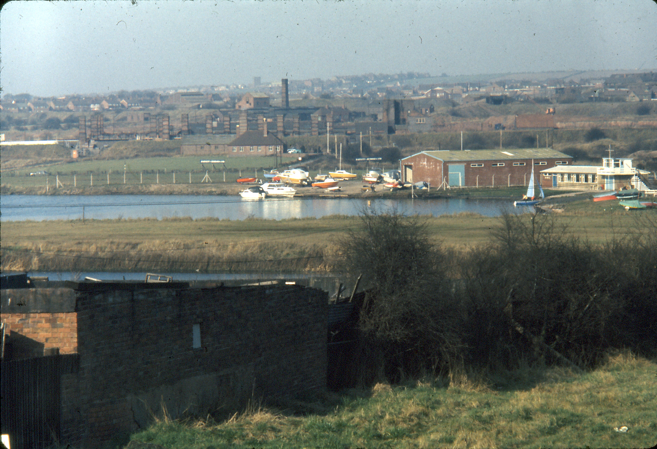
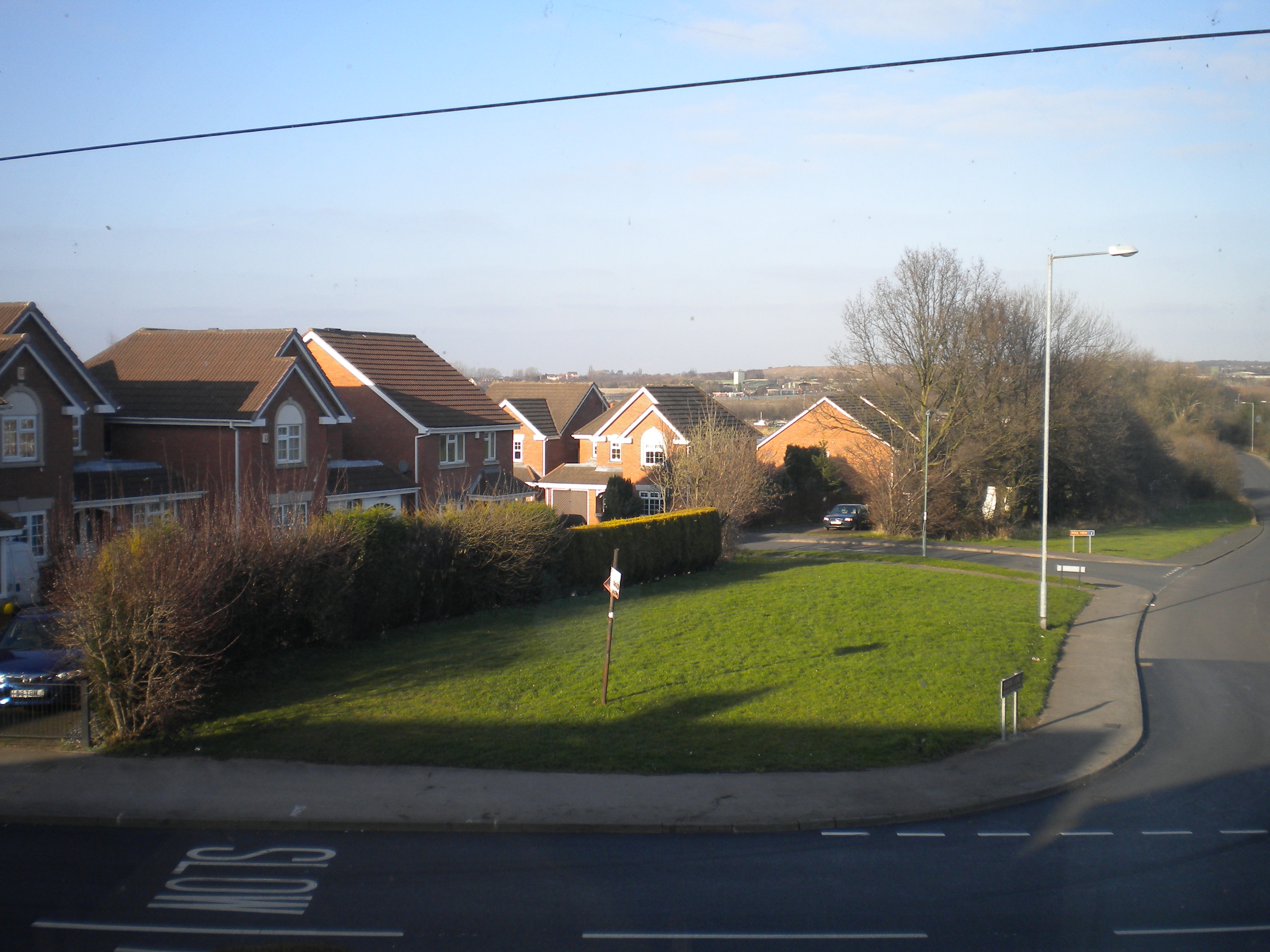
There’s houses in the way blocking a lot of the view, where previously there was Reg Edwards’ coal yard- some locals will probably still remember the very old red coal delivery lorry (which I’ll find a picture off at some point): these houses were built in the 80s or 90s.
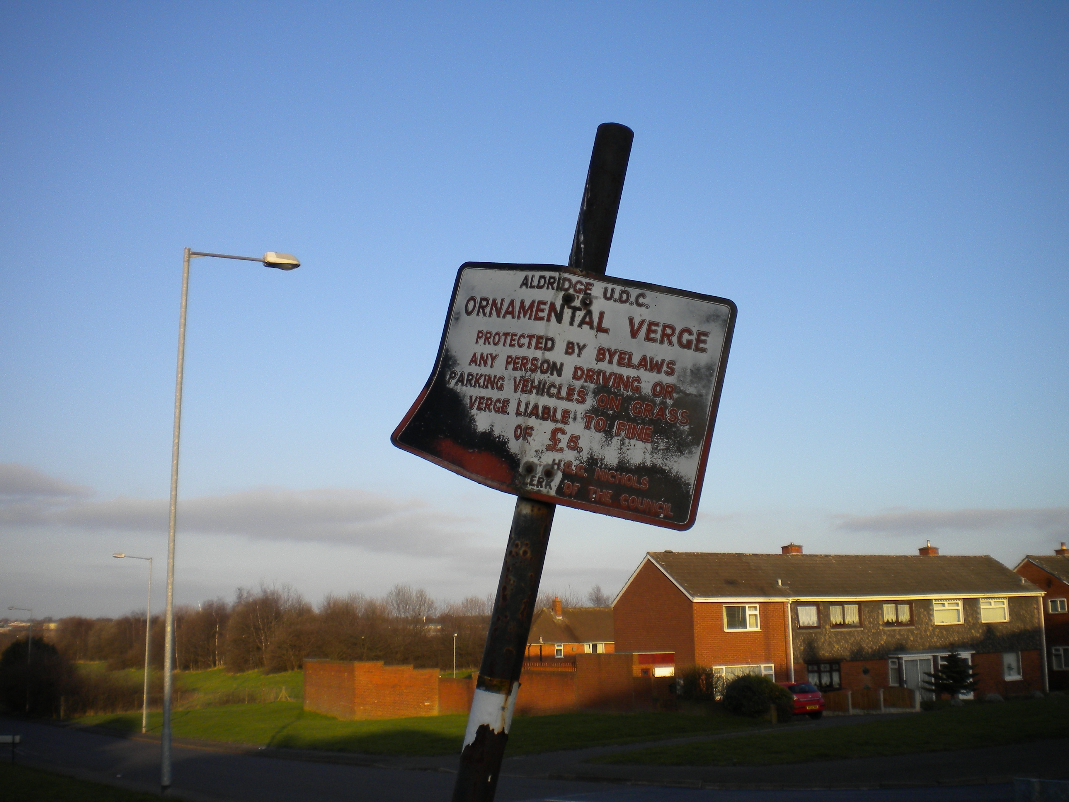
The trees have grown too, so what used to be a clear view to Brownhills past the brickworks is now obscured, mind you, now that it’s Veolia, that may be for the best. Also, the residents of Pool View may or may not be aware that their houses are stood in what used to be a pool- smaller than the one that still exists though, and used by local kids on makeshift rafts. The NSL speed limit signs have gone as well, sadly, but noticeably still there is the Aldridge UDC sign promising a £5 fine if you park on the verge:
Also of note just down the road, and something I was previously completely unaware of, this odd gateway just down the road:
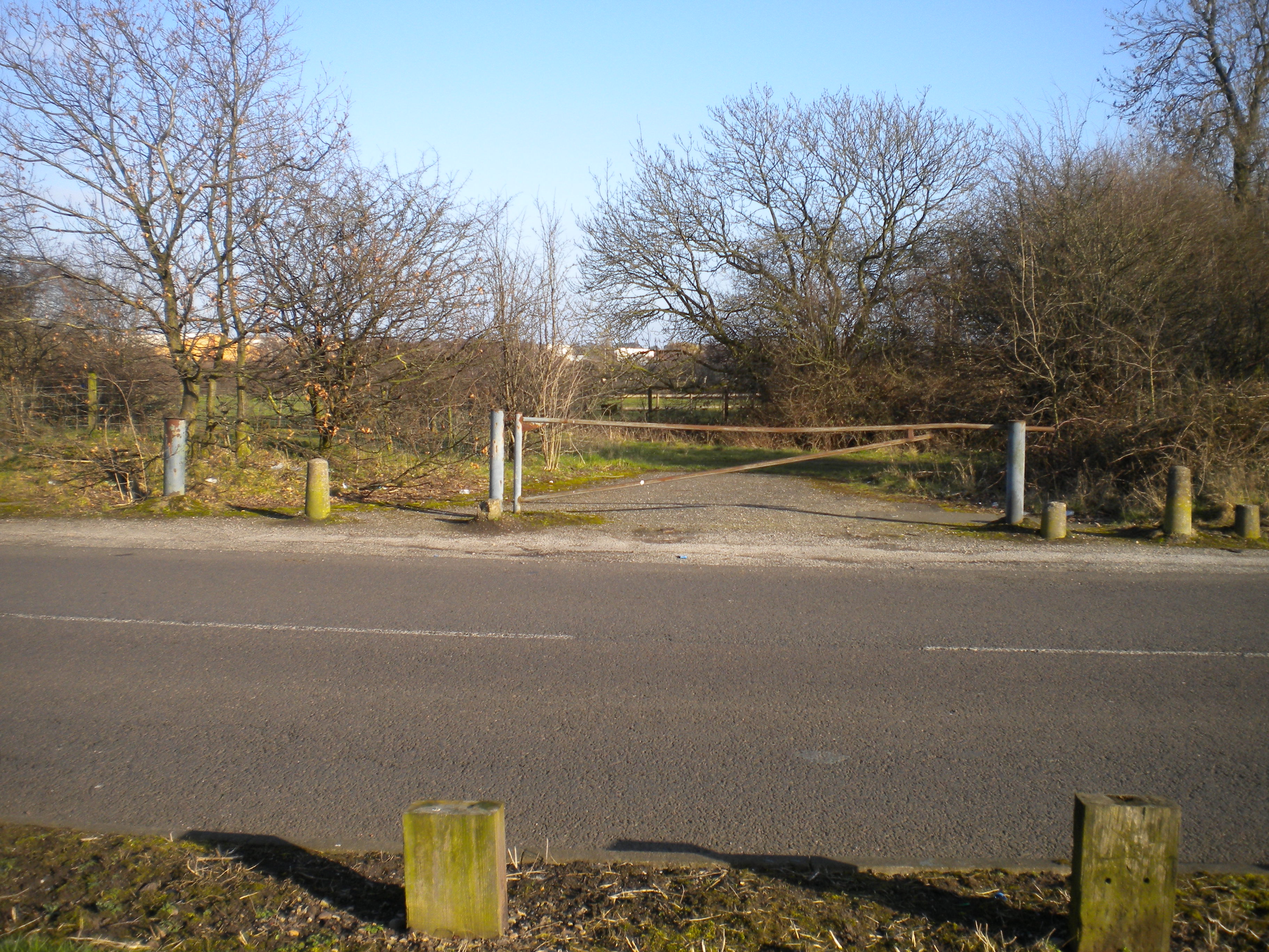
was once the end of Dumblederry Lane, before Westgate existed, if you look at this map (JPEG, 10.7MB) from BrownhillsBob’s excellent post from May 2010. The other end exists as a driveway by the side of a factory at the junction of Wharf Approach and Westgate:
though Google Maps shows a considerable stub of road at the Barns Lane end that isn’t there. The section of road was obliterated by a quarry, and Dumblederry Lane got truncated, with Westgate going around the quarry to joint with Barns Lane- the line of Westgate at this point was once just a farm track up to Linley Farm.
One thing that struck me (and is visible in the 1975 pics) was that when I was a lad there was a clearly defined path in the grass all the way down Barns Lane and along Stubbers Green Road, worn by people walking or cycling (and lots of them kids going to school). The paths have gone now, as they don’t get walked…
Very interesting.!
See you soon .
Love Mom
Happy days !! That was my route to school and there was a raised manhole half way down that path which I used to jump off with my bike. I can also remember catching the no.158 bus outside Edwards’ coal yard to school. At least the sailing club is still there.
That manhole cover was quite a ateep one, from what I remember, and the path a bit rough, so it was quite a brave jump really.